From field file to geological model, in your browser
Open your RES2DINV .dat file, clean the data, invert with topography, classify the geology, merge lines into a 3D block model and export the report. Nothing to install.
No credit card for the trial. Plans are quoted in your currency after a free training session.
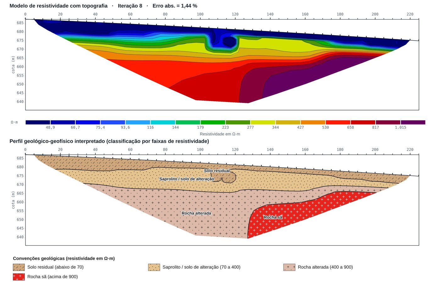
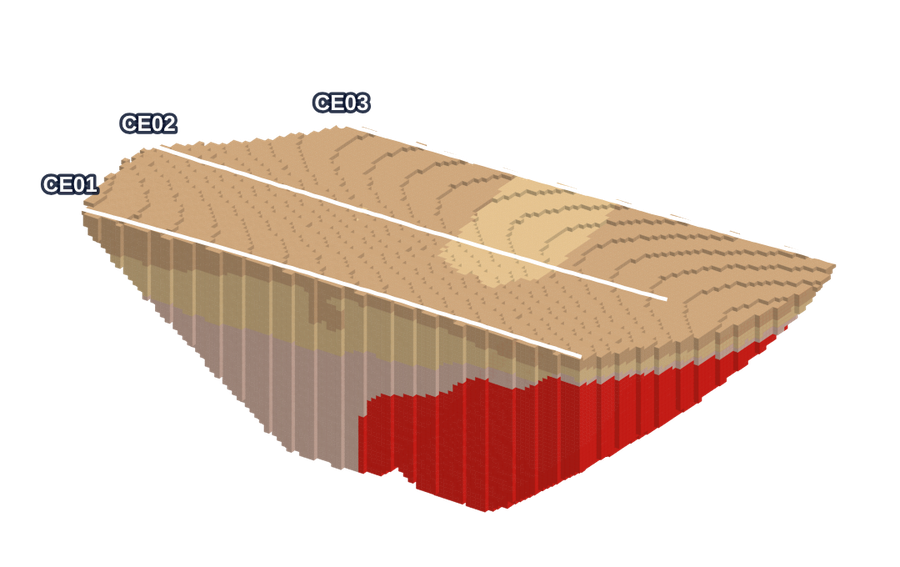
See the app in 45 seconds
Data, editing, inversion, geological profile, 3D model, maps and report, on a synthetic example survey.
Real app screens (Portuguese interface). The data are synthetic, created for the demo.
From the field to the 3D hydrogeological model
Built by people who do geophysics in the field.
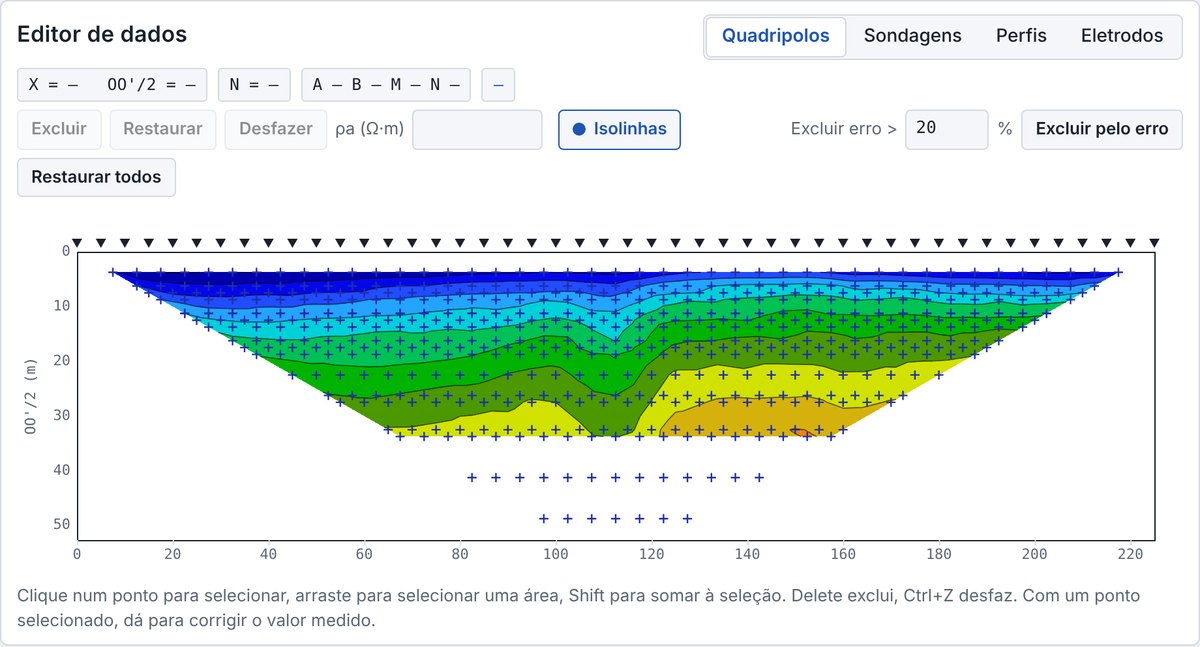
Open the file and clean the readings
RES2DINV .dat files and instrument .txt exports, with topography. Edit with four linked views of the same data.
- Quadripoles, soundings, profiles and electrode table
- Select, delete, undo and correct points
- Paste electrode elevations from Excel
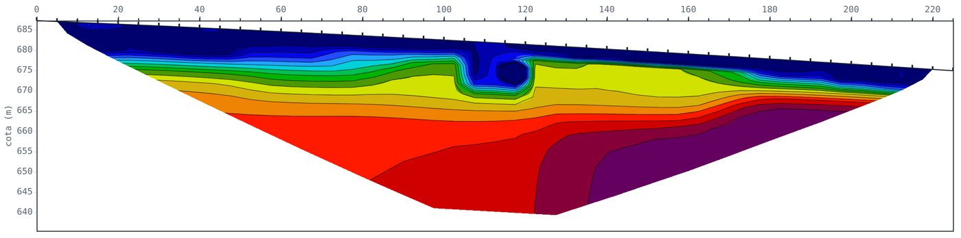
Inversion with topography, explained
2.5D finite-element modelling and smoothness-constrained Gauss-Newton, robust data or blocky model. Every parameter is explained inside the app.
- 1:1 scale and the classic RES2DINV palette
- Contours and JPEG export
- Convergence shown iteration by iteration
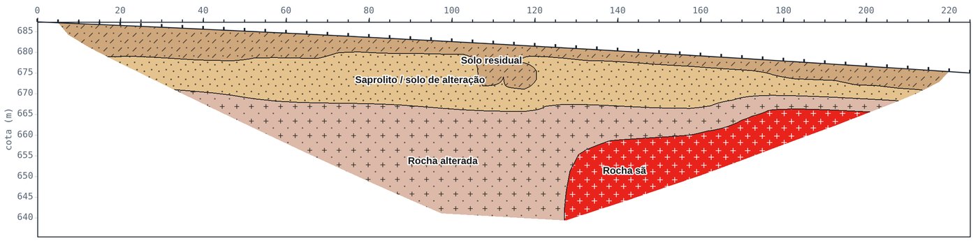
From resistivity to geological profile
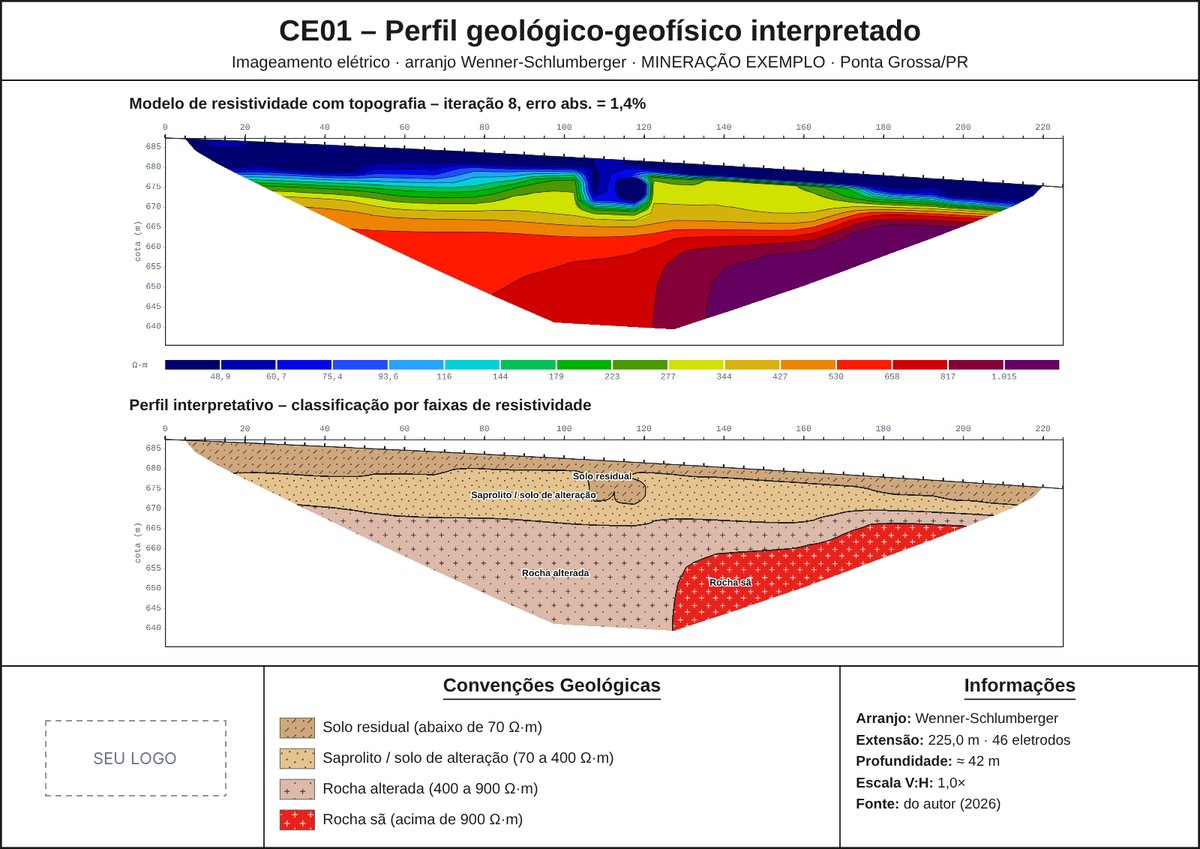
Set the resistivity range of each unit and the app draws the profile with colours, hatching, contacts and labels. Ranges apply to every line of the client.
- 68 lithologies with standard hatching
- Click a layer to change it
- Automatic range suggestion from the model
Several lines, one block model
With line coordinates and topography from DXF or shapefile, the app interpolates between sections and shows the geology in 3D, with top and thickness maps and volumes per lithology.
- Hide layers to see the bedrock surface
- Vertical sections in any direction
- Volumes and mean thickness per unit
A technical report ready to review
Cover, array methodology, plates for each line, interpretive profile, 3D model, tables and references in one Word file (in Portuguese). Clients and lines are saved in the cloud.
- Organised by client and line
- Automatic discussion of resistivity ranges
- Plates exported as images
Water table, groundwater flow and plume in 3D
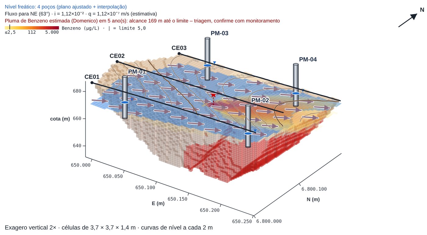
The water level picked on the sections and wells with measured levels build the potentiometric surface. The app computes the flow direction with Darcy’s law and estimates the contaminant plume with the Domenico solution, using the contaminant, source concentration and reference limit.
- Hydraulic gradient, velocity and plume reach, with the formulas on screen
- Wells drawn on the sections go to 3D with coordinates and elevations
- Hydraulic conductivity and porosity per layer
Suggested monitoring wells and water wells
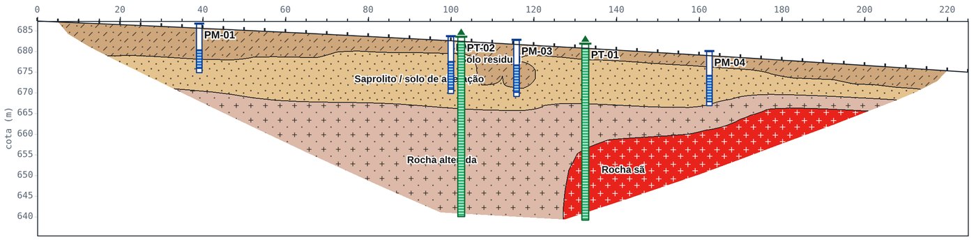
From conductivity, the app suggests monitoring wells around the conductive zone, with screen depth and coordinates. For water supply, it points to well locations in fractured rock or porous aquifers. Drag a well on the section to adjust it.
- Upgradient, side and downgradient wells around the plume
- Likely water entries and well depth
- Coordinate table ready for the field
And also
Tested on a model with a known answer
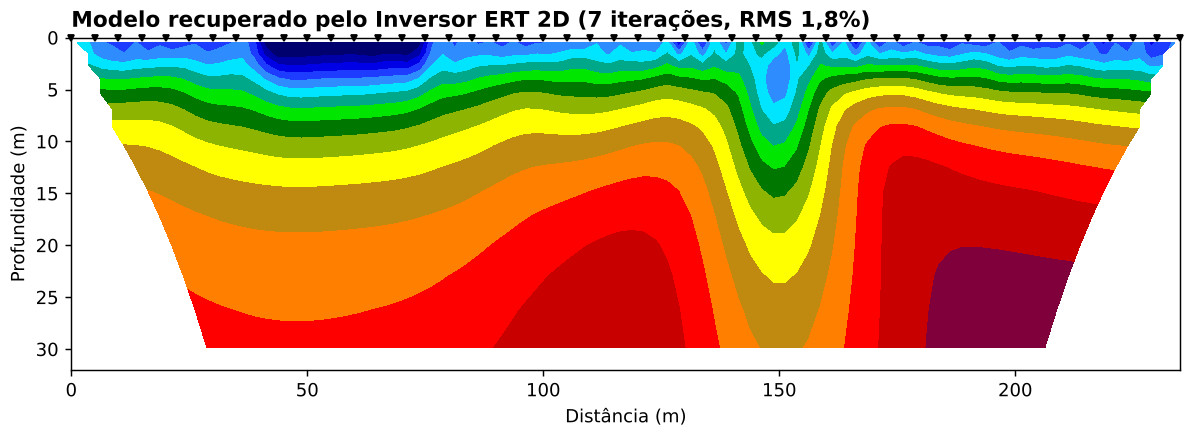
We built a synthetic subsurface, generated noisy data and let the software recover it. See the true model, the recovered model, the numbers and the limits.
Process one of your lines for free
Send us a survey you have already run. We send back the inverted section, the geological profile and the plate so you can compare them with your current software.
- Send us your fileBy e-mail or WhatsApp: the RES2DINV .dat or your instrument’s .txt, with topography if you have it.
- Tell us about the siteArray, electrode spacing and what you are looking for (water, contamination, bedrock…).
- Get your resultsInverted section, interpreted profile and plate within one business day.
Everything included, two plans
7-day free trial, no credit card. After a training session with your own data, you sign up directly with our team. Prices are in Brazilian reais (BRL).
Annual
12× R$ 249.90
R$ 2,998.80 for 12 months of access, about R$ 3,000 less than paying monthly.
- Unlimited clients and lines
- Editing, topography and 2D inversion
- Interpretive profile, 3D model, maps and volumes
- Hydrogeology, plume and well siting
- Word report, plates and images
- Training to get started
Monthly
R$ 499.90 / month
All features of the annual plan, paid month by month.
- All features of the annual plan
- Clients and lines saved in the cloud
- Training to get started
Questions
Is the app in English?
The interface is currently in Portuguese. We run the training session with you in English, using your own data, and the workflow follows the same steps as the software you already know.
How much does it cost?
Annual plan: 12 × R$ 249.90 (R$ 2,998.80 per year). Monthly plan: R$ 499.90 per month. Prices are in Brazilian reais (BRL). The trial is free for 7 days, no credit card.
Does it read my RES2DINV files?
Yes. It reads the standard .dat format (including topography) and the .txt exports of common resistivity meters.
Where is my data stored?
The inversion runs in your browser. Projects you choose to save are stored in your account, protected by login, and can be exported as files.
Run your first inversion today
Send us a line and see the result with your own data, or start the free trial now.